Ireland was officially neutral during the Second World War and the Irish government referred to the war as “the emergency”.
But part of the island of Ireland was at war and physically we are very close to the UK, so there was always a risk that German pilots could get confused about which country they were over.
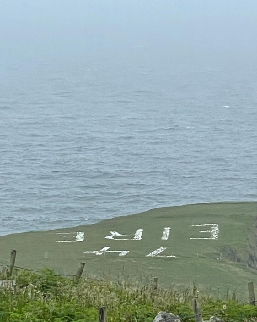
And so the Irish government set up the coastal watch to keep an eye on our coasts. Look out posts were built along the coast and these were accompanied by over 80 of these gigantic Eire signs. The numbers, which were added later, were helpful navigation aids for Allied pilots, as the Irish government shared the locations with the Allies. (So much for being neutral! – though Irish neutrality has always been little more than a fig leaf)
The signs measured 12 metres by 6 and used up to 150 tons of stone. Considering the locations of many of them aren’t exactly easy to get to that alone is a feat! The one below (no. 74) is in County Donegal:

It’s one of the preserved ones. Others were either covered over or simply dismantled for the stone.
There’s some interesting reading on the signs here and here.


Leave a Reply